Reduce Chart Production Time
ArcGIS for Aviation: Charting increases your aeronautical chart production efficiency by helping you to generate and manage charts from a central, database-driven system.
Produce charts to custom specifications
You can configure ArcGIS for Aviation: Charting to produce aeronautical charts to your cartographic specification using automated software tools and preconfigured aviation symbols. Easily create ICAO-compliant charts using included product templates.

Enhance data quality
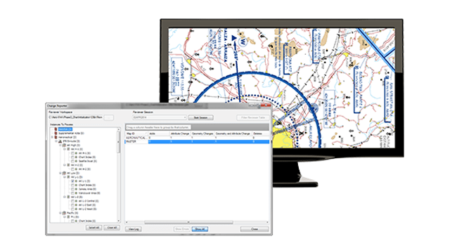
Improve your data quality by automating data update and quality control workflows. ArcGIS for Aviation: Charting gives you product-level change detection and on-the-fly rule-based validation tools. Standardise quality review processes across the organisation by sharing data validation rules with other business units.
Exchange data using AIXM
The aviation community is transitioning from analogue to digital data exchange. This requires the ability to work with digital Aeronautical Information Exchange Model (AIXM) datasets. ArcGIS for Aviation: Charting Includes software tools and data models configured specifically for AIXM support.