Manage your road network
Highway agencies manage and maintain a broad spectrum of information about their roadways. Often, this information is distributed throughout the agency in multiple, disparate systems. The public safety department might maintain crash data based on mileposts located along the highway, while the maintenance department may locate sign and pavement assets based on a distance from a known point of origin.
ArcGIS Roads and Highways is a linear referencing system solution that makes it possible for departments of transportation to integrate data from multiple linear referencing system (LRS) networks to get a comprehensive view of their roadways.
Integrate enterprise data
GIS-based enterprise LRS systems can easily become unsynchronised. ArcGIS Roads and Highways communicates updates to the LRS so you can continue working without waiting for the GIS to clear its edit queue. Connect GIS data with disparate systems for unified highway data-maintenance workflows.
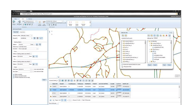
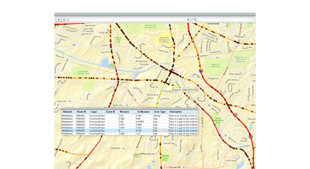
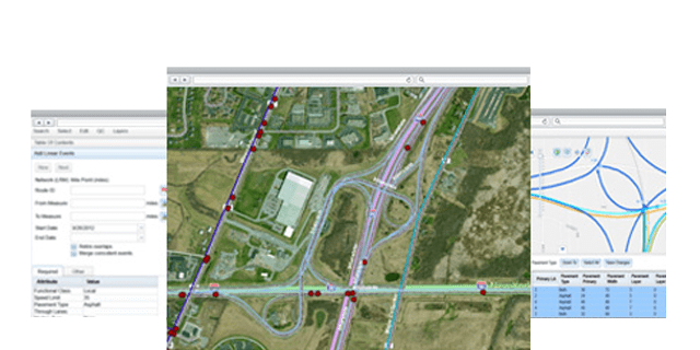
Maintain your LRS
Easily visualise and maintain your roadway networks and associated data with built-in and repeatable quality control and workflow management tools.
Exchange data using AIXM
Lessen the time it takes to generate essential roadway reports. Reports that support safety analysis, traffic congestion analysis, infrastructure maintenance planning and so on.