Realise the value of your bathymetric data
Get a comprehensive view of your bathymetry data assets. Store data once, reuse it many times.
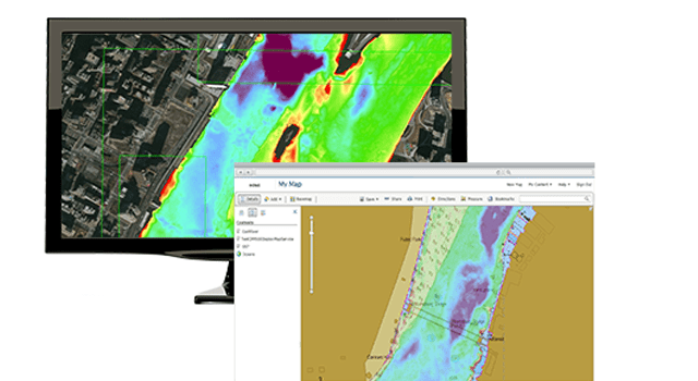
Make your data GIS-enabled
Use bathymetry data for better decision making and problem solving in offshore energy, port security, hydrographic services, dredging operations, scientific analysis and more. ArcGIS Bathymetry complements ArcGIS Maritime for a continuous and seamless chart production workflow.
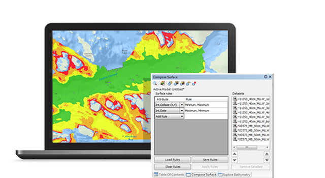
Manage and reuse your bathymetric data
Easily manage and combine massive amounts of raster and point bathymetric data and metadata in a GIS environment. The solution provides spatial analysis tools that allow you to realise the true value of your bathymetric data by analysing it in a geographic context.
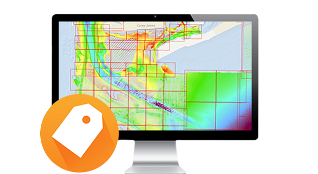
Work with metadata more easily
Instead of dealing with datasets that are missing critical information, like the coordinate system or sensors used, you'll have a traceable, S-102 compliant structure that you can use for data discovery and analysis. Capture metadata according to your requirements, from the sensor used to the colour of the boat.
Reduce the cost of data storage
Managing your data shouldn't mean creating another copy of it in a centralised location. ArcGIS Bathymetry allows you to register your datasets from their current location and manage them wherever they live, whether it is locally on your computer, or remotely on distributed file servers.
