Regeneration
Green spaces, well-planned roads, recreationand affordable housing - these features attract people to a community. Planners, economic developers and urban designers depend on the smart maps and spatial analytics in Esri's ArcGIS software to find the best ways to deliver what people want - a high quality of life and sustainable growth.
SUCCESS STORY
Meeting the needs of 10.5 million Londoners
The Greater London Authority (GLA) is pioneering a new, more collaborative approach to infrastructure planning to guide the long-term growth of the capital. Using Esri’s ArcGIS platform, it has developed an inventive web app that will help public and private sector organisations make better investment decisions and deliver the right infrastructure to meet the needs of over 10.5 million Londoners by 2041.
Guide growth
Use maps and analysis to guide open space, housing, infrastructure and industry policies.
Plan sustainably
Model and compare natural and built infrastructure plans for resiliency and prosperity.
Improve quality of life
Understand the movement of people, goods and services to inform development decisions.
Engage citizens
Use smart maps to gather input and share ideas with citizens and business leaders.
Specialised Apps
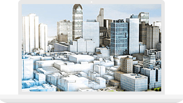
Esri CityEngine
Transform static data into 3D models to see projects from every angle, assess feasibility, and avoid costly mistakes.
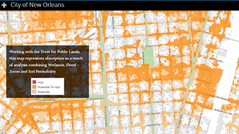
GeoPlanner for ArcGIS
Manage the entire planning process - data, site suitability, comparisons, and reporting - in one place. Access your planning dashboard anywhere, anytime.
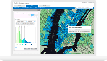
ArcGIS Business Analyst
Get data-driven maps and reports that show why your community is the best place to start or grow a business.
Learn more about ArcGIS Business Analyst for economic development