ArcGIS GeoPlanner
Data-informed planning that engages your audience
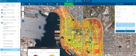
Plans driven by impact and KPIs
ArcGIS GeoPlanner gives you a way to measure the impact of your design using key performance indicators (KPIs). Run spatial analysis on the fly, compare scenarios and share data-informed plans using real-time dashboards.
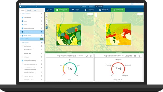
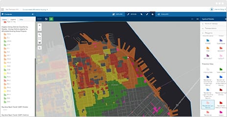
Design what-if scenarios
Design and test countless iterative scenarios with professional planning tools in ArcGIS GeoPlanner. And you can invite other planners to collaborate with you.
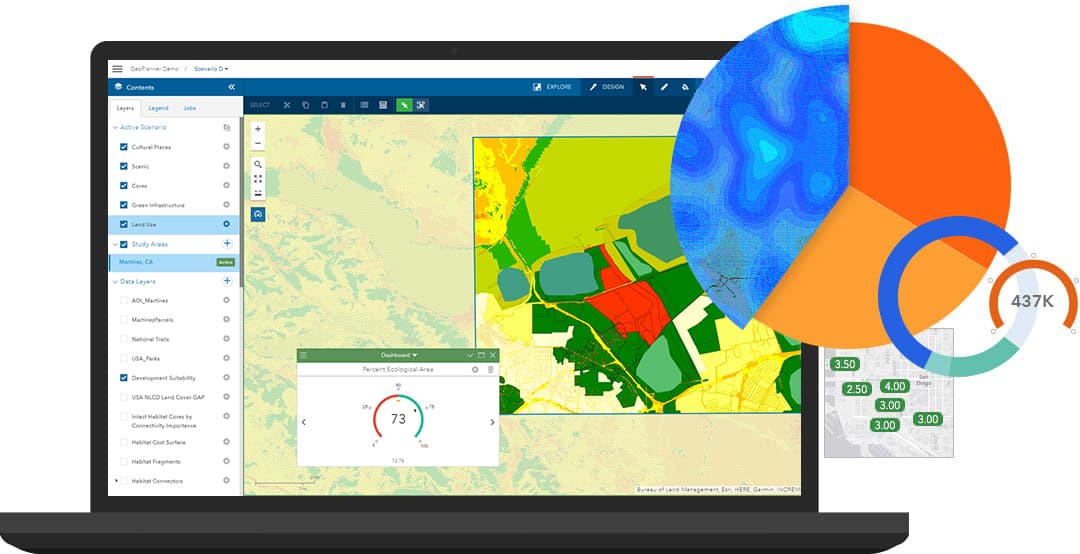
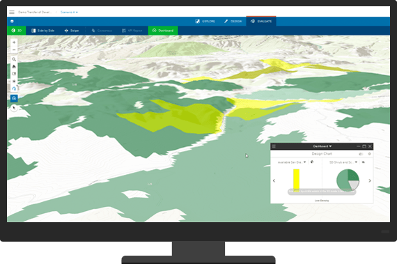
Measure impact as you plan
Use built-in metrics and dashboards to immediately measure scenario impact. Access and incorporate global, authoritative data from ArcGIS for contextual analysis.
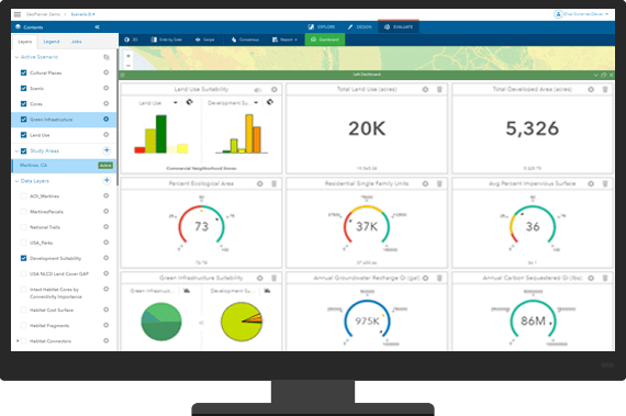
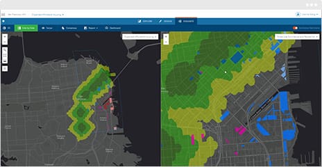
Deliver results that get buy-in
Showcase results that are data-informed, visually impactful and interactive in 2D and 3D. Share plans with stakeholders and the community at meetings or charrettes.
Improve your process, one step at a time
Planning is an iterative, collaborative process. Here’s how ArcGIS GeoPlanner helps you every step of the way.
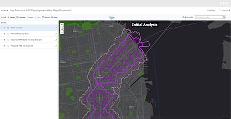
1. Design
Create scenarios from your data or sketch new designs. Collaborate with a team or design on your own.
2. Test
Assess and compare impact in 2D or 3D with real-time dashboards, key performance indicators and models.
3. Share
Present data-informed results to executives, officials and your community.

Case study
Cost-Benefit Analysis of Future Development
Placer County, California needed an efficient way to analyse changes and perform financial impact analysis in-house and in real time.

Go above and beyond with ArcGIS
Share your work more broadly, obtain feedback from the community and take your analysis to the next level with these supporting products.

ArcGIS Online
ArcGIS Online is a cloud-based mapping platform that Esri manages and scales for you. Add GeoPlanner for ArcGIS as a premium app to design and share scenarios.
Learn about ArcGIS Online
Esri Story Maps
With Esri Story Maps, turn your plans into attractive storytelling web applications that are accessible through any device - no coding required.
Explore Esri Story Maps
ArcGIS Survey123
Use ArcGIS Survey123 to engage the community with an easy-to-use survey app that helps you gather feedback on the plans you generated with GeoPlanner for ArcGIS.
Discover ArcGIS Survey123
ArcGIS Pro
Take work done in GeoPlanner for ArcGIS and use ArcGIS Pro to perform more advanced analytics such as complex geoprocessing models.
Get to know ArcGIS Pro