Official Statistics
Statistical and civil registration products inform national decision-making. To ensure high-quality data, organisations need a statistical geospatial framework that integrates geospatial and statistical data. GIS platforms facilitate the requisite collection of accurate information as well as its dissemination and analysis.
SUCCESS STORY
Simplifying the census in CaboVerde
Until 2010, INE, the national statistics organisation in Cabo Verde, used paper maps to conduct censuses. By modernising with GIS, INE Cabo Verde integrated a framework to prepare, process and distribute census data, reducing the time necessary to produce census maps by 40 percent.
Specialised Apps

ArcGIS Survey123
Replace unreliable paper-based data collection with an automated digital solution that fits the needs of field personnel and management.

ArcGIS Collector
Put mapping into the hands of your field workforce to validate enumeration areas and improve the accuracy of basemaps and spatial data.
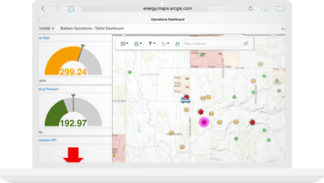
ArcGIS Dashboard
Stay on top of your operations by monitoring, tracking, and reporting on your daily operations in real time.
See how ArcGIS is driving innovation

Resources
VIDEOS

Realizing the potential of GIS

Integrating data at the US Census Bureau

Dr. Dozie Ezigbalike on flexible information