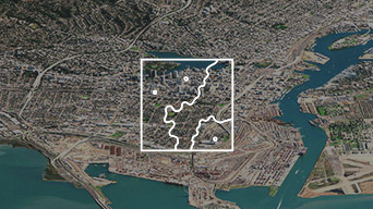
National Mapping & Charting
Communities require authoritative information to make timely decisions. National mapping and charting organisations must deliver this information to help people unlock the value of data for decision-making. Modernising their workflows enables them to do this more efficiently and effectively.
SUCCESS STORY
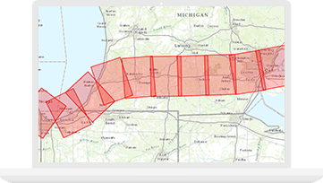
First-of-its-kind mapping product provides immense value to UK customers
Ordnance Survey (OS) released a world-first, fully automated mapping product derived from large scale source data. With the single press of a button OS is able to create a premium national dataset, using the most up-to-date OS source data in just eight days.
Collect
Integrate data from many sources into a single platform.
Manage
Securely and accurately manage information to confidently move data throughout the organisation.
Analyse & produce
Streamline your workflows and analysis to produce unlimited data-driven, authoritative products.
Share
Unlock data’s full potential by working smarter with better internal and external collaboration.
Specialised Apps

ArcGIS Drone2Map
Apply innovative image processing capabilities - in minutes, not days - to remote sensing, 2D and 3D mapping.
ArcGIS Production Mapping
Improve the quality and value of your geospatial output using modern, efficient production workflows.

ArcGIS Open Data
Open data provides a quick way to set up public-facing websites where people can easily find and download public data in a variety of open formats.