Optimise your map production
Improve the quality and value of your geospatial output through standardisation, repeatability and configuration of your production processes. ArcGIS Production Mapping helps you create and maintain large amounts of specification-driven GIS data and maps on strict schedules.
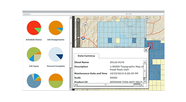
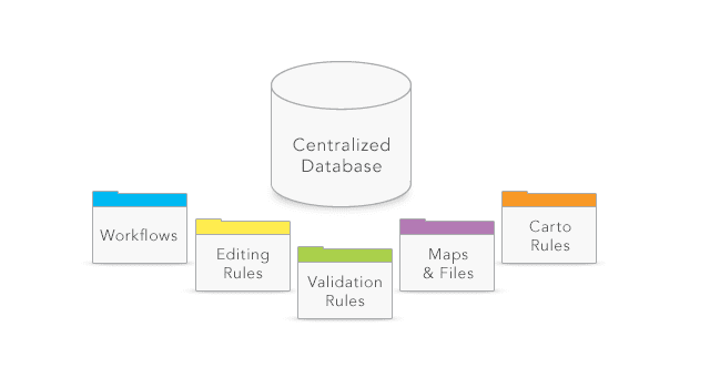
Centralise operations
Store production-related information such as business rules, workflows, tasks, data and map documents in a secure, centralised location. This ensures consistency across operations so you can do more with fewer resources.
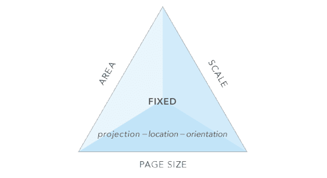
Meet exacting standards
Ensure that features and maps conform to data collection and cartographic standards using the rules you store in Production Mapping. Production Mapping's configurable architecture is designed to support industry/organisational specifications while remaining flexible to adapt to custom requirements.
On-demand product generation
Enable non-GIS users to define and print their own maps via the web. The maps print to the specifications an organisation establishes and include the same map grids, distance scales and legends users are accustomed to in high-quality printed maps.
Share your work on the web
ArcGIS Production Mapping for Server delivers a dynamic, self-service online map production experience across operations by storing business rules, map documents and other production information in a centralised location. ArcGIS Production Mapping for Server is available on Windows only for ArcGIS Enterprise Advanced and ArcGIS Enterprise Standard.
