Elected & Appointed Officials
Quality of life depends on real-time decision-making. Location intelligence lets you quickly see where things are happening and how information is connected - from responding to citizens to funding a mandate. GIS connects citizens and government to support transparency and evidence-based problem solving.
Support policy
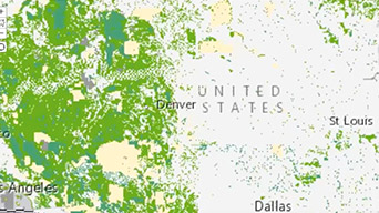
Map resources, assets and incidents nationwide to understand how they intersect with proposed policies.
Measure performance
Adapt programs in real-time using dashboards. Analyse policy impact by measuring issue correspondence and its yields.
Engage citizens
Map member visits, future engagements and rates of correspondence on maps that embed on websites and social media.
Specialised Apps
ArcGIS Insights
Answer questions you didn't know to ask and quickly get results using a web-based data analytics workbench for exploring data.
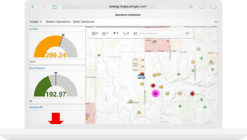
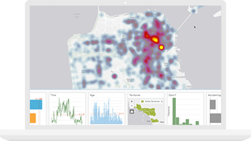
Operations Dashboard for ArcGIS
Monitor activities and stay aware of unfolding events by using real-time maps and infographics. Use data to respond faster and adjust to changing conditions.
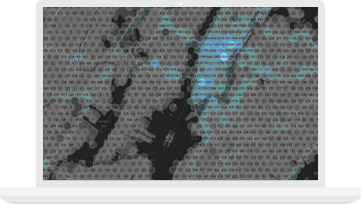
Real-time GIS
Analyse and display real-time, streaming data from sensors, mobile devices and social media feeds. Automatically tailor your focus to the events that matter most.

ArcGIS Hub
Transform how you engage and collaborate with your community. Provide a two-way engagement platform to connect government and citizens.