Estate Management
ArcGIS software delivers commercial off-the-shelf (COTS) solutions for estate management, cadastre and valuation functions. It increases efficiency, improves data quality and better conveys the status of every project. Improve service delivery, make better decisions and complete tasks faster.
Public relations
Provide real-time access to answers and information to strengthen public trust.
Assessment & valuation
Understand how location impacts property values and use spatial analytics to improve valuations.
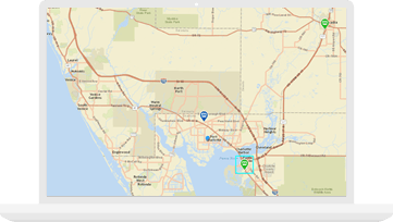
Field operations
Easily schedule, manage and route your field staff to improve efficiencies.
Cadastre
Increase efficiency, maintain parcel history and improve data integrity with purpose-built workflows.
Specialised Apps
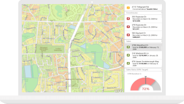
Value Analysis Dashboard
Access to all your valuation and property information in a single location to easily identify outliers, sales ratios, cost per square foot and value changes over time.
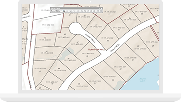
Parcel Editing Suite
Improve cadastral data with specialised apps. Better examine deeds, validate property descriptions and publish property information using purpose-built workflows.
Public Engagement Suite
Inform the public with a modern set of maps and apps specifically designed to aid public access to information such as tax, parcel or comparable land sales data.