Air Operations
The ArcGIS Platform brings the power of location analysis to the RAF. Already adopted across UK Defence, Five Eyes and NATO, ArcGIS helps military and civilian staff manage, analyse and integrate geospatial data across all areas.
ArcGIS FOR AIR OPERATIONS
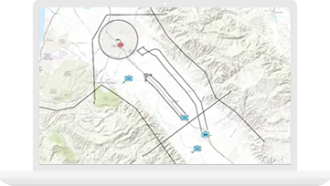
An air force is dependent on a wide range of data, from the latest reconnaissance imagery to weather data. ArcGIS plays a key role in visualising, analysing and sharing understanding, to help organisations turn data into actionable intelligence and make better decisions.
Improve Situational Awareness
Visualise information to form a clearer understanding of any given situation
Support Decision Making
Analyse information to better understand and predict, to enable informed decisions and gain operational advantage
Enhance Collaboration
Exchange operational information and analysis with Land and Maritime, with NATO and Coalition Partners
Technology Highlights

ArcGIS Enterprise & Portal
A complete geospatial platform that runs behind your firewall, on-premises and in the cloud, and works with your enterprise systems and policies.

Resources


Partners
Esri partners offer specialied solutions built on ArcGIS to solve your real-world challenges.